suasnews.com
By Gary Mortimer
-3 February 2017

Horray for Google, their patent that went through yesterday has given me a most excellent excuse to post my favourite drone video of 2016 once again, Robot Drone Man Fly!
First the Google patent.
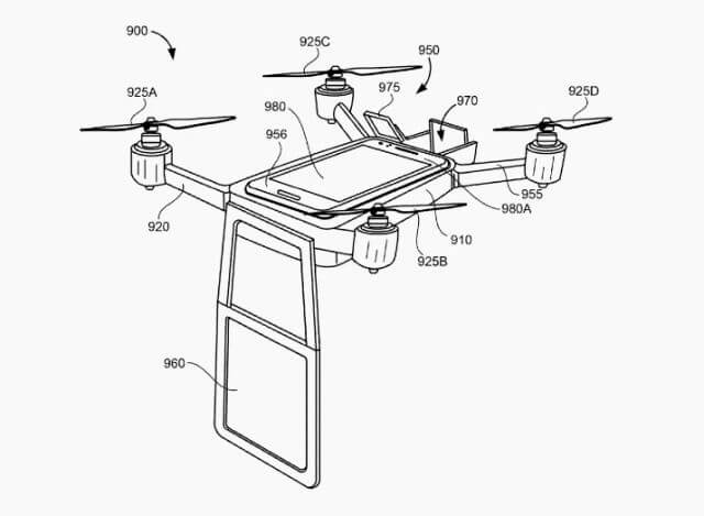
A mobile telepresence system may include a frame, a propulsion system operably coupled to the frame to propel the frame through a designated space, a screen movably coupled to the frame, and an image output device coupled to the frame. The frame may include a central body defining a longitudinal axis of the frame, a first arm at a first end portion of the central body, and a second arm at a second end portion of the central body, opposite the first end portion of the central body. The propulsion system may include rotors at opposite end portions of the first and second arms which propel the frame in response to an external command. The image output device may project an image onto the screen in response to an external command.
Now the most excellent video.
Several smartphone based quadcopters are coming to market, any of them would be able to complete this task. Much like anyone at the meeting connecting to the person wishing to join via Skype could also complete the task.
Another thing that pops straight to mind is that a DJI Mavic has all the sensors to avoid hitting things, makes a SLAM map on the fly can connect to Facebook Live. Just as long as your meeting does not go over 28 minutes and nobody has shut a door you are good to go. The only thing it does not have is the screen to show your face.
Over the horizon flying into rescue situations and able to communicate almost face to face. I get that; it would be reassuring while physical help was en route. Or Maybe Google really has another office environment in mind, collapsed ones.
#RobotDroneManFly come on sing along now. It’s a Friday earworm.
Read more:
Wow, What an Outstanding post. I found this too much informatics. It is what I was seeking for. I would like to recommend you that please keep sharing such type of info.If possible, Thanks. drone aerial mapping
ReplyDelete