By Press
26 January 2017

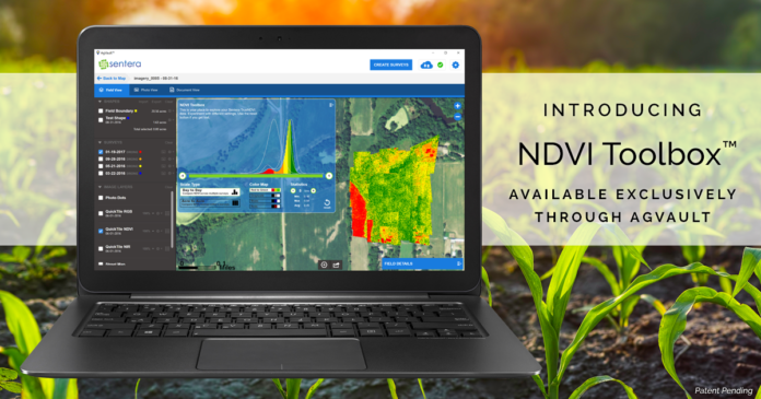
Sentera today announced the release of its NDVI Toolbox™ for AgVault™: a set of tools for customizable Normalized Difference Vegetation Index (NDVI) data that give growers and agronomists significant insight into field and crop health, today and throughout the season. Users can recolor, dynamically regenerate, and highlight areas of an NDVI Crop Health Map, on data gathered today, and on historical data. The NDVI Toolbox is now a standard feature of Sentera’s AgVault™ Software Pro and Viewer licenses.
“Until now, you needed to choose between viewing data tailored for NDVI progression over time, or tailored for NDVI contrast around a single flight – but, you couldn’t do both,” said Greg Emerick, executive vice president for Sentera. “We changed that. Now, growers and agronomists have that flexibility. They are more in control of their operations, and can make even better decisions, even faster.”
Why this matters
NDVI essentially compares one area to another, illustrated with colour. If a crop is generally healthy, it appears bright green on an NDVI map. This is generalised data, however, and is only useful in general terms. AgVault’s NDVI Toolbox makes that data actionable by building flexibility into the colour map. Instead of blanketing an NDVI map with low variation of a single colour, the NDVI Toolbox allows you to force dramatic colour variations to show a plant’s health relative to others in the field at a granular level.
Fly once, and areas of concern can be zoomed in on in AgVault, and assigned a wider variation in colour value for easier analysis; the average person can identify areas of stress, compaction or drown-outs. Fly multiple times, and see problem areas as they emerge. Perpetual problem areas can be investigated and remedied effectively – even going back to previous flights to see when issues emerged. Or re-analyzing data from the past in different ways.
“Every time you fly an NDVI sensor and collect data, AgVault catalogues the data and the NDVI Toolbox becomes more robust, offering more accurate data,” remarked Reid Plumbo, director of product management for Sentera, “It just gets better and better.”
AgVault’s NDVI Toolbox features two viewing options:
Day to Day – Growers can monitor and compare a field over time, highlighting changes from one day to the next. The Day-to-Day view ensures growers can pinpoint areas that have flourished or become stressed over time and take action. Multiple data sets build on one another.
Acre to Acre – Allows growers to determine the overall vigor of a field, identify problems, and take action. This is all completed with a single data set.
“Our customers have been asking for this exact solution, and we’re honored to have brought this answer to the precision ag industry,” said Plumbo.
The NDVI Toolbox is available now with Sentera’s AgVault™ Software Pro and Viewer license options.
For more information on Sentera’s NDVI Toolbox capability, visit: https://sentera.com/agvault-software/#ndvi-toolbox
Patent pending.
About Sentera
With more than 220 years of combined experience with sensors, software, UAV, data management, and engineering solutions, Sentera is a leading designer, developer, and manufacturer of remote-sensing technologies in the agriculture, infrastructure, and public safety industries. In a single growing season, Sentera’s equipment gathered over 175 terabytes of data from 8,000 flights. The company recently passed a milestone of collecting more than 25,000,000 acres of images. For more information, visit www.sentera.com.
Read more:
No comments:
Post a Comment