Showing posts with label drone delivery. Show all posts

Wednesday, February 15, 2017

Drone Delivery Service Develops For Commercial Industries

Droneblog
February 13, 2017


Technology is developing. More and more devices and machines are becoming “smart.” With connection to the internet, they connect to each other and present endless opportunities.

Robot delivery has climbed high on the tech development agenda.

Catching the attention of headlines and Super Bowl fans, drone delivery services are swiftly approaching the commercial market. Amazon has taken the lead in this development race and gave a 10-second sneak peek teaser of “Prime Air.”

In December, drone delivery made its first successful go-round in a rural corner of England, where it has been beta-testing. Carrying up to five pounds, drones can deliver in under 30 minutes. In the future, nearby drone delivery warehouses will provide thousands of product options.

With vertically rising drones flying up to 400 feet in the air, the sky is no longer the limit.


THE PROCESS OF DRONE DELIVERY

Though not quite ready, Amazon promised it would be available “soon.” But after the successful beta-tests in England, drone confidence is rising.

Amazon’s speedy delivery service “Prime Now” is already offered in select markets. While these deliveries can be made in under an hour, the service depends on human drivers. Which also makes it subject to traffic conditions.

Battery-operated delivery drones can travel about 15 miles away. They have the ability to sense and avoid both air and land-based obstacles. Using a GPS system, the delivery drones can quickly generate the best route and even communicate with each other.

Like so much of today’s tech operations, users can use communicate with delivery drones via smart phones. Users can use their smart phone to select delivery options such as: “Bring it to Me,” “Home,” “Work,” and “My Boat.” Additionally, if the customer relocates, the drones can redirect mid-route.

While apartment buildings are still a bit complicated for drone routes, doorstep delivery throughout neighborhoods has been easily mastered.

Amazon has invested nearly $1.5 billion to create an air cargo hub in Kentucky for further drone development. The project will provide over 2,000 jobs to work on aero plane development.

Though giant screen TV’s will still require a typical truck delivery, special drone warehouses will make selections from tech gadgets to movie snacks quickly available. However, as drone weight options increase through future development, their useful applications will extend far beyond simple convenience deliveries.


THE FEDEX DELIVERY SERVICE RIVALRY

Right now Amazon holds a clear lead in futuristic delivery services. The leading online retailer made a smart move with the Super Bowl commercial snippets. They’re an excellent delivery service with a winning online medium between buyers and suppliers.

Now FedEx is clamoring for attention, working to gain grounds in delivery services.

FedEx wants to increase their user-friendliness in delivery. They have just announced an e-commerce solution for integrated supply chain distribution. They’re providing a logistics network for small and medium-sized businesses in special warehouse storing.

Their focus is on improved automation. As a third-party logistics provider, FedEx transports packages to businesses and consumer’s doorsteps cheaply. The e-commerce delivery service has cultivated a reputation for reliability.

FedEx is delivering products for companies that have already developed their own online presence, so their improvement approaches have been a bit different. Logo specialization has recently been made available to businesses. While their products are shipping from FedEx warehouses, these companies now have the option to have packages shipped with their unique logo.

FedEx’s chief information officer, Rob Carter, has recently announced emerging AI and robotics tech initiatives. Part of that investment focuses on autonomous truck driving development, which could completely reshape FedEx delivery.

Your FedEx package may someday be delivered by a robot.

Whether its Amazon, FedEx or Uber, autonomous delivery and transportation technologies are developing fast.

Guest Contribution by Allison Crady, a Marketing Specialist for a commercial construction conglomerate, including CDF Distributors and Fast Partitions. She spends most of her time researching and writing about a myriad of industry topics, including innovative construction, home improvement, urban trends, and city planning.

TAGS
Amazon
Drone Delivery
FedEx
Uber
Read more:
http://droneblog.com/2017/02/13/drone-delivery-service-develops-for-commercial-industries/

Friday, February 3, 2017

Rwanda forges forward in drone mapping use

droneblog.com
By Droneblog Editor
February 2, 2017


After Rwanda made waves in the news early last year for allegedly being the first country to approve drone delivery, people payed attention. The country, with its rolling hills and one of the fastest growing economies in Central Africa has already established regulations regarding drones and become a vanguard of sorts for the region.

“My impression is that there is a huge market in Africa at the moment,” said Francesco Nex, assistant professor at the ITC Faculty, University of Twente. “They are growing very fast, with a shortage of surveying and maps available.” Nex recently taught photogrammetry for an applied drone mapping training at INES-Ruhengeri Institute in Rwanda, along with his colleagues Rohan Bennett, and Anton Vrieling.

The Netherlands annually sponsors such continued education events for former students of Dutch institutes, and for 2016 the University of Twente organized a course in Rwanda on the latest drone mapping techniques. “They were very, very, enthusiastic,” Nex said of the 196 applicants, from which they selected 20 students from 8 neighboring countries. “Most of them asked me very specific questions for specific problems. They really knew what they were looking for and had big expectations for this course and the use of drones.”

The training consisted of three parts: making orthophoto maps, 3D reconstructions, and topography models from UAV images in Pix4Dmapper software; mapping applications in land administration, and mapping applications in food security.


The ability to map a crop using multispectral images to better understand its quality has potential to expand the practice of precision agriculture. Gerald Forkuor, lead remote sensing scientist for WASCAL and training attendee, explained that the predominance of subsistence farming in the region means small field sizes, which require a cheap and efficient imaging system to capture them. In addition, “Persistent cloud cover prevents optical sensors from acquiring cloud-free images during the main cropping season,” said Forkuor. “Knowledge of how UAVs can support in reducing such effects is very necessary.”

Leonard Sweta, training attendee and GIS analyst at the Centre for Mapping of Resources for Development (RCMRD) in Kenya, stated that learning how to create 3D models and calculate vegetation indices in Pix4Dmapper were the most valuable part of the training. He aims to derive new techniques in land innovation and agriculture from them.

“The idea was to explain how to use UAV images to update maps, for cadastral,” said Nex. “Most of the country has cadastral maps that are very out of date — from flights done sometimes over 20 years ago. There are also big informal settlements. This means there are large areas where you don’t know what’s going on.” Where there are mapping agencies with aircraft in the region, often sensors are not included and need to be rented, creating an impractical and expensive solution.


Mireille Biraro, head of the department of land administration and management at INES-Ruhengeri, attended the course to learn Pix4D’s drone photogrammetry workflow for land administration activities. “In Rwanda, we used aerial images to register land.” Said Biraro. “But those images were captured with a plane. UAVs can be a potential tool to acquire new imagery to update the existing.”

As in Rwanda, drones are beginning to be recognized around the world as a powerful surveying solution. Accessible in terms of price and availability, their sensors quickly capture data that can be turned into valuable topographical and agricultural information in Pix4Dmapper software. Eyes are on Rwanda as it uses, and spreads knowledge of, drone photogrammetry solutions.

To learn more about Pix4D drone photogrammetry, Click Here.

SOURCEPix4D


Read more:
http://droneblog.com/2017/02/02/rwanda-forges-forward-in-drone-mapping-use/

Wednesday, January 11, 2017

BMW Concept Car could Receive Drone Deliveries on the Move


uasvision.com
January 11, 2017


bmw-design-cars-transport-electric-vehicles-ces_dezeen_2364_col_5
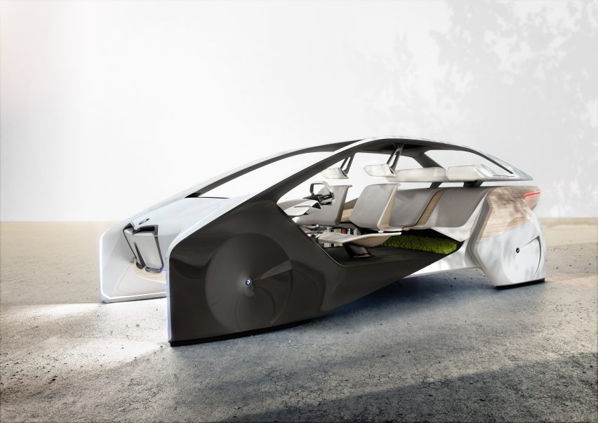
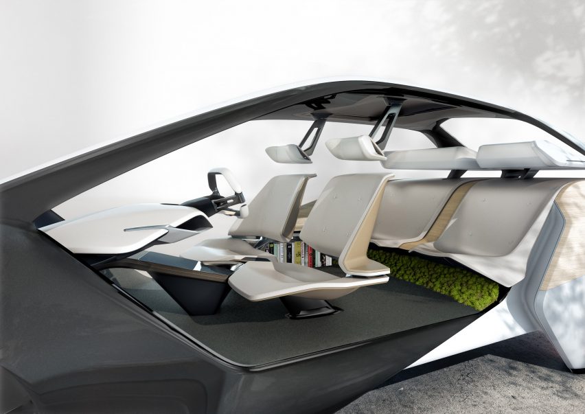
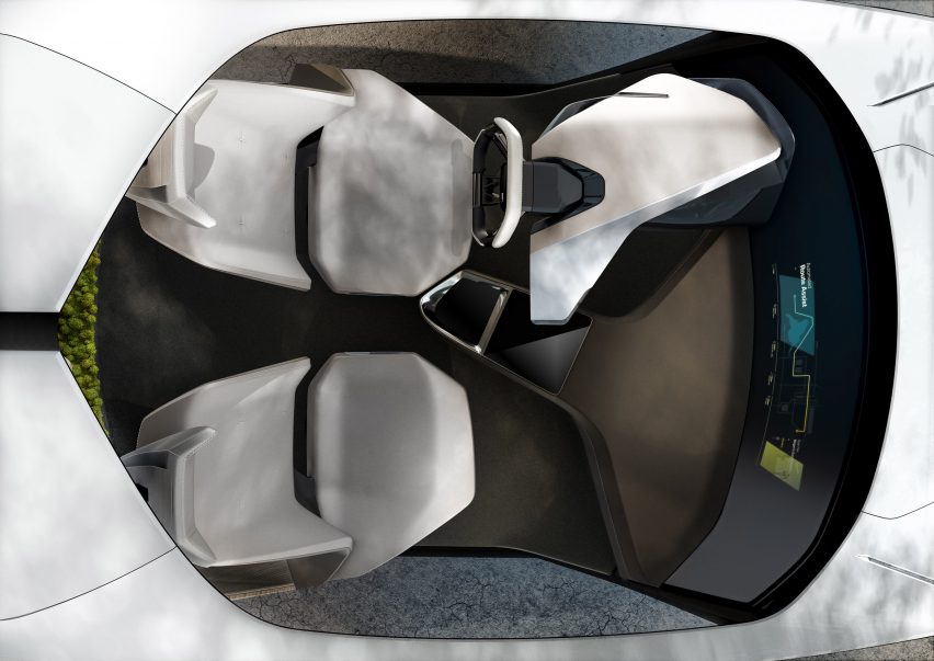
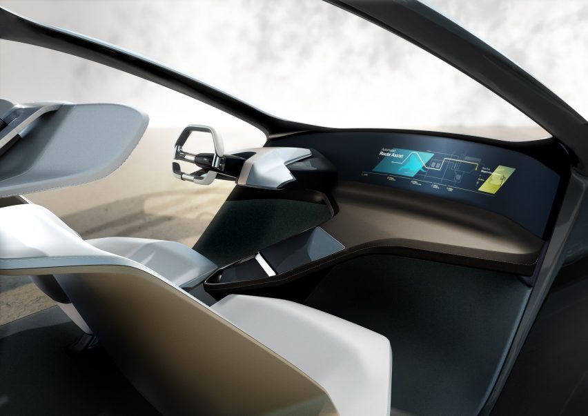
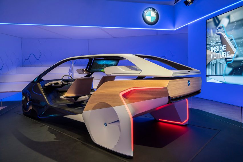
BMW has transformed its 5 Series Sedan into a futuristic concept vehicle that can drive and park itself, understand gestures and even receive drone deliveries on the road.
The German automotive brand has utilised connected home technologies into its conceptual car prototype, unveiled this week at the Consumer Electronics Show (CES) in Las Vegas.
Its aim is to demonstrate how the next generation of personal vehicles will not only feature automated driving, but will also be able to connect up with the owners’ other electronic devices, via the internet of things.

bmw-design-cars-transport-electric-vehicles-ces_dezeen_2364_col_0

“Connectivity means extensive data sharing, which is not only important for safe and convenient mobility with a highly automated element but opens up other possibilities too,” said BMW.
“For example, intelligent connectivity between the vehicle, the driver and the outside world also creates new opportunities for drivers to plan their personal mobility experience and integrate it with the rest of their daily life.”

bmw-design-cars-transport-electric-vehicles-ces_dezeen_2364_col_3

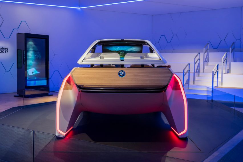
Featuring a futuristic exterior with concealed wheels and strip lighting, the modified Sedan is linked up to BMW’s digital platform, the Open Mobility Cloud.
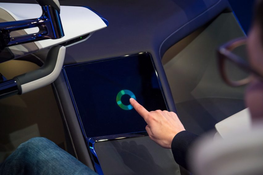
Users can connect to this using smartphones and smartwatches, or via digital touch points on the car.

bmw-design-cars-transport-electric-vehicles-ces_dezeen_2364_col_6

This system is able to recognise different methods of communication.
It includes voice recognition, as well as a gesture-control system, allows users to give different types of instruction or to source information about their surroundings.

bmw-design-cars-transport-electric-vehicles-ces_dezeen_2364_col_2

One of the major features the car could offer in the future is Amazon En-Route Delivery.
By order goods through the app, drivers could schedule drone deliveries further along the route.

bmw-design-cars-transport-electric-vehicles-ces_dezeen_2364_col_7

An intelligent automated driving mode is included, which is able to notify drivers in advance about which sections of the route can be fully automated.
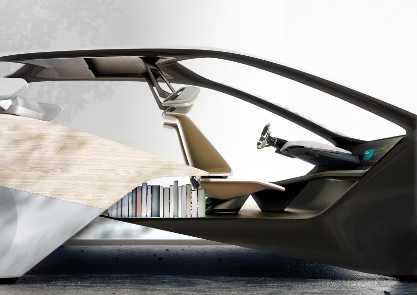
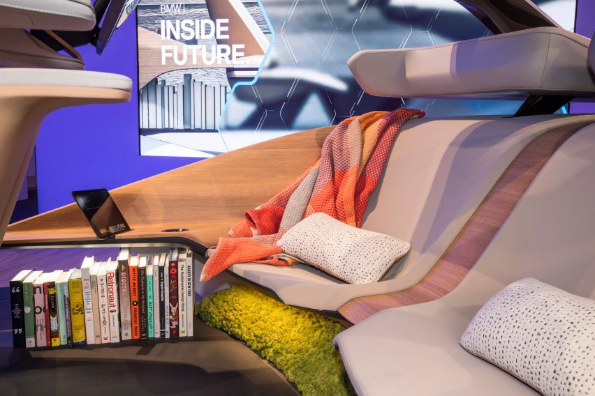
This makes it easy to plan other activities – in fact, visuals of the car show a bookshelf integrated into the interior.

bmw-design-cars-transport-electric-vehicles-ces_dezeen_2364_col_14

For sections of the road where the driver takes control, information systems can help to make the journey easier, for instance, real-time traffic light information will let drivers know how long they have before the next green.

bmw-design-cars-transport-electric-vehicles-ces_dezeen_2364_col_10

Another feature is a robot valet parking service – a fully automated parking procedure, similar to the one that Faraday Future is also presenting at CES.
The driver is sent a text notification once the car is parked.

bmw-design-cars-transport-electric-vehicles-ces_dezeen_2364_col_15

BMW is among a number of automotive brands presenting at CES, which runs from 5 to 8 January 2017.
Source: Dezeen

Read more at:
http://www.uasvision.com/2017/01/11/bmw-concept-car-could-receive-drone-deliveries-on-the-move/#more-47747